Pink Beds short loop in Pisgah National Forest
- Distance: 5.7 Km
- Elevation gain: 60 m
- Maximum elevation: 1,007 m
- Elevation loss: 57 m
- Minimum elevation: 977 m
- Moving time: 2 h 3 m
- Moving speed: 2.8 Km/h
- Maximum speed: 4.6 Km/h
- Total time: 2 h 55 m
- Global speed: 1.9 Km/h
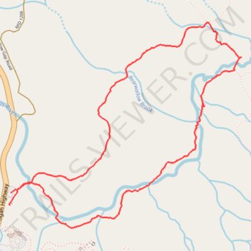
Interactive trail map
Trail profile
- Distance: 5.7 Km
- Elevation gain: 60 m
- Maximum elevation: 1,007 m
- Elevation loss: 57 m
- Minimum elevation: 977 m
- Moving time: 2 h 3 m
- Moving speed: 2.8 Km/h
- Maximum speed: 4.6 Km/h
- Total time: 2 h 55 m
- Global speed: 1.9 Km/h
About this trail
Name: Pink Beds short loop in Pisgah National Forest trail, distance, elevation, map, profile, GPS track
Start: Pisgah Highway, Transylvania County, North Carolina, United States (35.35247 -82.77903)
Coordinates: 35.35105 -82.77907 35.36417 -82.76086