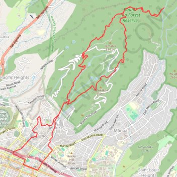
Trail Router route
- Distance: 22.0 Km
- Elevation gain: 1,288 m
- Maximum elevation: 573 m
- Elevation loss: 1,288 m
- Minimum elevation: 9 m
Interactive trail map
Trail profile
- Distance: 22.0 Km
- Elevation gain: 1,288 m
- Maximum elevation: 573 m
- Elevation loss: 1,288 m
- Minimum elevation: 9 m
About this trail
Name: Trail Router route trail, distance, elevation, map, profile, GPS track
Coordinates: 21.29870 -157.84255 21.34225 -157.79930
Other hiking, mountain biking, running and outdoor activity trails
Click on a trail to view its statistics, map and profile.
Honolulu Hawaii, Makiki Valley Trail Loop
United States > Hawaii > Honolulu County > Honolulu
Round Top Forest Reserve
Distance: 5.0 Km • Elevation gain: 311 m • Maximum elevation: 335 m