Зуслан чэллэнж
- Distance: 79.2 Km
- Elevation gain: 1,330 m
- Maximum elevation: 1,634 m
- Elevation loss: 1,325 m
- Minimum elevation: 1,304 m
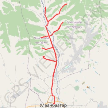
Interactive trail map
Trail profile
- Distance: 79.2 Km
- Elevation gain: 1,330 m
- Maximum elevation: 1,634 m
- Elevation loss: 1,325 m
- Minimum elevation: 1,304 m
About this trail
Name: Зуслан чэллэнж trail, distance, elevation, map, profile, GPS track
Start: Санзайн зам, Chingeltei, Ulaanbaatar, Mongolia (48.04020 106.90464)
End: Chingeltei, Ulaanbaatar, Mongolia (48.04036 106.90333)
Coordinates: 47.92586 106.88819 48.08472 106.95072
Other hiking, mountain biking, running and outdoor activity trails
Click on a trail to view its statistics, map and profile.
UDA 7 davaa challenge
Distance: 135.2 Km • Elevation gain: 2,583 m • Maximum elevation: 2,015 m