Lake Chanon Loop from Fenton
Fenton Road Cycling
- Distance: 40.7 Km
- Elevation gain: 329 m
- Maximum elevation: 328 m
- Elevation loss: 329 m
- Minimum elevation: 270 m
- Moving time: 1 h 38 m
- Moving speed: 24.7 Km/h
- Maximum speed: 53.7 Km/h
- Total time: 1 h 46 m
- Global speed: 22.9 Km/h
Interactive trail map
Trail profile
- Distance: 40.7 Km
- Elevation gain: 329 m
- Maximum elevation: 328 m
- Elevation loss: 329 m
- Minimum elevation: 270 m
- Moving time: 1 h 38 m
- Moving speed: 24.7 Km/h
- Maximum speed: 53.7 Km/h
- Total time: 1 h 46 m
- Global speed: 22.9 Km/h
About this trail
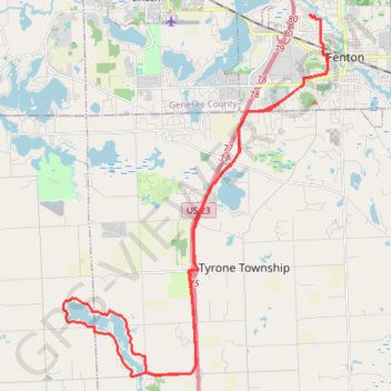
Name: Lake Chanon Loop from Fenton trail, distance, elevation, map, profile, GPS track
Coordinates: 42.70695 -83.81410 42.80982 -83.71175