Thank you for supporting this site ❤️
Make a donation
Make a donation
Gear up for your next adventure:
As an Amazon Associate, this site earns from qualifying purchases at no extra cost to you.
Stone Bridge Loop Trail
- Distance: 4.3 Km
- Elevation gain: 23 m
- Maximum elevation: 61 m
- Elevation loss: 23 m
- Minimum elevation: 51 m
- Moving time: 56 m 50 s
- Moving speed: 4.5 Km/h
- Maximum speed: 14.0 Km/h
- Total time: 1 h 10 m
- Global speed: 3.6 Km/h
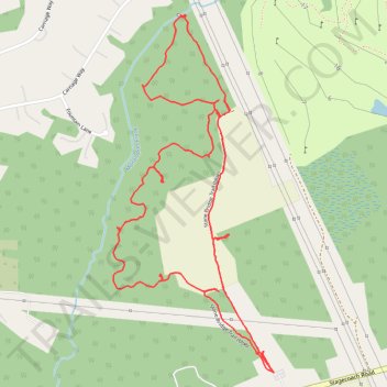
Interactive trail map
Thank you for supporting this site ❤️
Make a donation
Make a donation
Gear up for your next adventure:
As an Amazon Associate, this site earns from qualifying purchases at no extra cost to you.
Trail profile
- Distance: 4.3 Km
- Elevation gain: 23 m
- Maximum elevation: 61 m
- Elevation loss: 23 m
- Minimum elevation: 51 m
- Moving time: 56 m 50 s
- Moving speed: 4.5 Km/h
- Maximum speed: 14.0 Km/h
- Total time: 1 h 10 m
- Global speed: 3.6 Km/h
Thank you for supporting this site ❤️
Make a donation
Make a donation
Gear up for your next adventure:
As an Amazon Associate, this site earns from qualifying purchases at no extra cost to you.
About this trail
Name: Stone Bridge Loop Trail trail, distance, elevation, map, profile, GPS track
Coordinates: 40.20430 -74.37358 40.21448 -74.36761
Thank you for supporting this site ❤️
Make a donation
Make a donation
Gear up for your next adventure:
As an Amazon Associate, this site earns from qualifying purchases at no extra cost to you.