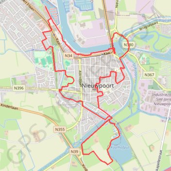
Stadswandelroute Nieuwpoort
- Distance: 10.1 Km
- Elevation gain: 19 m
- Maximum elevation: 9 m
- Elevation loss: 19 m
- Minimum elevation: -1 m
Interactive trail map
Trail profile
- Distance: 10.1 Km
- Elevation gain: 19 m
- Maximum elevation: 9 m
- Elevation loss: 19 m
- Minimum elevation: -1 m
About this trail
Name: Stadswandelroute Nieuwpoort trail, distance, elevation, map, profile, GPS track
Coordinates: 51.11835 2.73923 51.14043 2.75864
Other hiking, mountain biking, running and outdoor activity trails
Click on a trail to view its statistics, map and profile.
1 - 32 km (32 km) - 08 Jun 21
Belgium > West Flanders > Veurne > Koksijde > Oostduinkerke
Distance: 32.0 Km • Elevation gain: 117 m • Maximum elevation: 25 m