
Murdock Lake Trails
- Distance: 8.5 Km
- Elevation gain: 85 m
- Maximum elevation: 101 m
- Elevation loss: 84 m
- Minimum elevation: 63 m
- Moving time: 30 m 18 s
- Moving speed: 16.9 Km/h
- Maximum speed: 39.9 Km/h
- Total time: 2 h 6 m
- Global speed: 4.0 Km/h
Interactive trail map
Trail profile
- Distance: 8.5 Km
- Elevation gain: 85 m
- Maximum elevation: 101 m
- Elevation loss: 84 m
- Minimum elevation: 63 m
- Moving time: 30 m 18 s
- Moving speed: 16.9 Km/h
- Maximum speed: 39.9 Km/h
- Total time: 2 h 6 m
- Global speed: 4.0 Km/h
About this trail
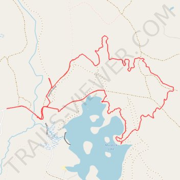
Name: Murdock Lake Trails trail, distance, elevation, map, profile, GPS track
Start: Ridlon Road, Berwick, York County, Maine, 03901, United States (43.33015 -70.88977)
End: 252, Ridlon Road, Berwick, York County, Maine, 03901, United States (43.33124 -70.89474)
Coordinates: 43.32704 -70.89474 43.33986 -70.86764