
2026-10-24_09-56_Satholmes jungle
- Distance: 6.7 Km
- Elevation gain: 45 m
- Maximum elevation: 30 m
- Elevation loss: 63 m
- Minimum elevation: 5 m
- Moving time: 54 m 44 s
- Moving speed: 7.3 Km/h
- Maximum speed: 47.0 Km/h
- Total time: 1 h 20 m
- Global speed: 5.0 Km/h
Interactive trail map
Trail profile
- Distance: 6.7 Km
- Elevation gain: 45 m
- Maximum elevation: 30 m
- Elevation loss: 63 m
- Minimum elevation: 5 m
- Moving time: 54 m 44 s
- Moving speed: 7.3 Km/h
- Maximum speed: 47.0 Km/h
- Total time: 1 h 20 m
- Global speed: 5.0 Km/h
About this trail
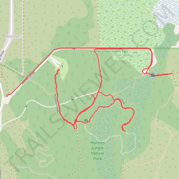
Name: 2026-10-24_09-56_Satholmes jungle trail, distance, elevation, map, profile, GPS track
Start: Holmes Jungle, Holmes, Darwin, Northern Territory, 0812, Australia (-12.39853 130.92429)
End: Jungle Walk, Holmes, Darwin, Northern Territory, 0812, Australia (-12.39837 130.93041)
Coordinates: -12.40098 130.92427 -12.39507 130.93632
Topography: Darwin topographic map, elevation, terrain