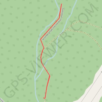
Import a GPX file

Stromberg Falls

Texada Island. #Hiking #Texada

  • Distance: 1.5 Km
  • Elevation gain: 68 m
  • Maximum elevation: 147 m
  • Elevation loss: 68 m
  • Minimum elevation: 78 m

Interactive trail map

Trail profile

  • Distance: 1.5 Km
  • Elevation gain: 68 m
  • Maximum elevation: 147 m
  • Elevation loss: 68 m
  • Minimum elevation: 78 m

About this trail

Gear up for your next adventure:

🎒Daypacks - Compact backpacks for short hikes
🧢Outdoor Sun Hats - Sun protection hats for hiking
🥾Heavy Duty Hiking Boots - Ankle-supporting boots for carrying heavy packs on steep contours
📱Shockproof Phone Cases - Extra protection for your smartphone against drops on rocky terrain
🔌Fast Charging Adapters - Quickly top up all your gear before heading back into the field

As an Amazon Associate, this site earns from qualifying purchases at no extra cost to you.