
Piste 06 - principale (niveau 2)
- Distance: 55.1 Km
- Elevation gain: 703 m
- Maximum elevation: 751 m
- Elevation loss: 1,072 m
- Minimum elevation: 213 m
Interactive trail map
Trail profile
- Distance: 55.1 Km
- Elevation gain: 703 m
- Maximum elevation: 751 m
- Elevation loss: 1,072 m
- Minimum elevation: 213 m
About this trail
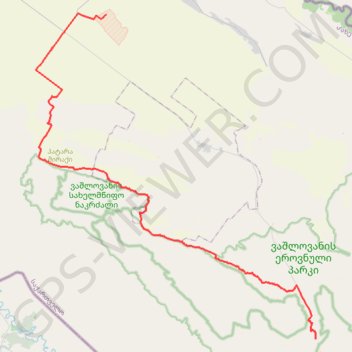
Name: Piste 06 - principale (niveau 2) trail, distance, elevation, map, profile, GPS track
End: Road to Mijniskure, Dedoplistsqaro Municipality, Kakheti, Georgia (41.13923 46.57974)
Coordinates: 41.13923 46.29404 41.38991 46.58016