Lesotho - Semonkong
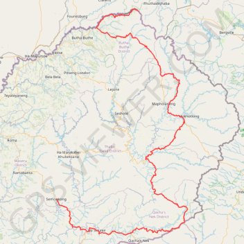
Interactive trail map
Trail profile
- Distance: 572.4 Km
- Elevation gain: 16,124 m
- Maximum elevation: 3,277 m
- Elevation loss: 15,948 m
- Minimum elevation: 1,512 m
About this trail
Name: Lesotho - Semonkong trail, distance, elevation, map, profile, GPS track
End: A5, Ha Lepae (Semonkong), Semonkong, Maseru District, Lesotho (-29.84053 28.05309)
Coordinates: -30.07824 28.05308 -28.57545 29.05633
Other hiking, mountain biking, running and outdoor activity trails
Click on a trail to view its statistics, map and profile.
Thukela Falls - Sentinel
South Africa > Free State > Thabo Mofutsanyana District Municipality > Maluti-a-Phofung Local Municipality
Distance: 12.7 Km • Elevation gain: 1,003 m • Maximum elevation: 3,006 m