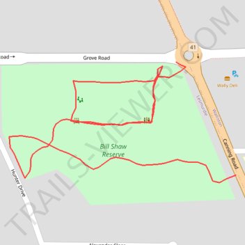
Bill Shaw Reserve Paths
- Distance: 0.9 Km
- Elevation gain: 9 m
- Maximum elevation: 302 m
- Elevation loss: 8 m
- Minimum elevation: 294 m
- Moving time: 5 m 34 s
- Moving speed: 10.2 Km/h
- Maximum speed: 18.0 Km/h
- Total time: 21 m 23 s
- Global speed: 2.7 Km/h
Interactive trail map
Trail profile
- Distance: 0.9 Km
- Elevation gain: 9 m
- Maximum elevation: 302 m
- Elevation loss: 8 m
- Minimum elevation: 294 m
- Moving time: 5 m 34 s
- Moving speed: 10.2 Km/h
- Maximum speed: 18.0 Km/h
- Total time: 21 m 23 s
- Global speed: 2.7 Km/h
About this trail
Name: Bill Shaw Reserve Paths trail, distance, elevation, map, profile, GPS track
Coordinates: -32.00187 116.06561 -32.00064 116.06833
Topography: Western Australia topographic map, elevation, terrain