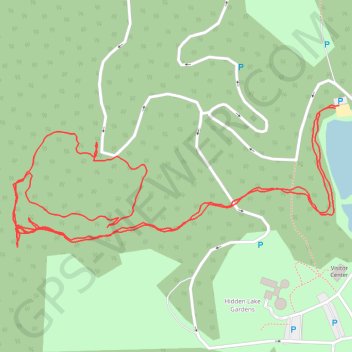
Hidden Lake Gardens Kettle Hole Trail
- Distance: 2.9 Km
- Elevation gain: 32 m
- Maximum elevation: 322 m
- Elevation loss: 31 m
- Minimum elevation: 297 m
- Moving time: 51 m 25 s
- Moving speed: 3.4 Km/h
- Maximum speed: 12.3 Km/h
- Total time: 1 h 13 m
- Global speed: 2.4 Km/h
Interactive trail map
Trail profile
- Distance: 2.9 Km
- Elevation gain: 32 m
- Maximum elevation: 322 m
- Elevation loss: 31 m
- Minimum elevation: 297 m
- Moving time: 51 m 25 s
- Moving speed: 3.4 Km/h
- Maximum speed: 12.3 Km/h
- Total time: 1 h 13 m
- Global speed: 2.4 Km/h
About this trail
Name: Hidden Lake Gardens Kettle Hole Trail trail, distance, elevation, map, profile, GPS track
Coordinates: 42.03021 -84.11733 42.03241 -84.11055