Caribou Mountain Hike Yukon Canada
- Distance: 8.7 Km
- Elevation gain: 1,028 m
- Maximum elevation: 1,753 m
- Elevation loss: 1,029 m
- Minimum elevation: 733 m
- Moving time: 3 h 28 m
- Moving speed: 2.5 Km/h
- Maximum speed: 15.3 Km/h
- Total time: 5 h 37 m
- Global speed: 1.5 Km/h
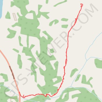
Interactive trail map
Trail profile
- Distance: 8.7 Km
- Elevation gain: 1,028 m
- Maximum elevation: 1,753 m
- Elevation loss: 1,029 m
- Minimum elevation: 733 m
- Moving time: 3 h 28 m
- Moving speed: 2.5 Km/h
- Maximum speed: 15.3 Km/h
- Total time: 5 h 37 m
- Global speed: 1.5 Km/h
About this trail
Name: Caribou Mountain Hike Yukon Canada trail, distance, elevation, map, profile, GPS track
Start: Klondike Highway, Whitehorse, Yukon, Canada (60.22680 -134.72682)
End: Klondike Highway, Whitehorse, Yukon, Canada (60.22683 -134.72692)
Coordinates: 60.22536 -134.72692 60.24706 -134.69751