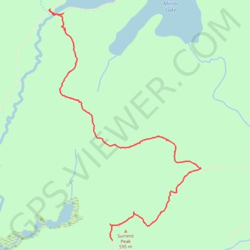
Mirror Lake to Summit Peak
- Distance: 3.7 Km
- Elevation gain: 152 m
- Maximum elevation: 590 m
- Elevation loss: 55 m
- Minimum elevation: 468 m
- Moving time: 50 m 5 s
- Moving speed: 4.4 Km/h
- Maximum speed: 7.7 Km/h
- Total time: 1 h 13 m
- Global speed: 3.0 Km/h
Interactive trail map
Trail profile
- Distance: 3.7 Km
- Elevation gain: 152 m
- Maximum elevation: 590 m
- Elevation loss: 55 m
- Minimum elevation: 468 m
- Moving time: 50 m 5 s
- Moving speed: 4.4 Km/h
- Maximum speed: 7.7 Km/h
- Total time: 1 h 13 m
- Global speed: 3.0 Km/h
About this trail
Name: Mirror Lake to Summit Peak trail, distance, elevation, map, profile, GPS track
Coordinates: 46.74599 -89.78004 46.76120 -89.76545