
Short walk along Ogden River
- Distance: 1.4 Km
- Elevation gain: 6 m
- Maximum elevation: 1,317 m
- Elevation loss: 5 m
- Minimum elevation: 1,311 m
- Moving time: 19 m 55 s
- Moving speed: 4.3 Km/h
- Maximum speed: 10.0 Km/h
- Total time: 19 m 55 s
- Global speed: 4.3 Km/h
Interactive trail map
Trail profile
- Distance: 1.4 Km
- Elevation gain: 6 m
- Maximum elevation: 1,317 m
- Elevation loss: 5 m
- Minimum elevation: 1,311 m
- Moving time: 19 m 55 s
- Moving speed: 4.3 Km/h
- Maximum speed: 10.0 Km/h
- Total time: 19 m 55 s
- Global speed: 4.3 Km/h
About this trail
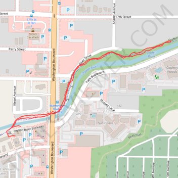
Name: Short walk along Ogden River trail, distance, elevation, map, profile, GPS track
End: Ogden River Parkway, Ogden, Weber County, Utah, 84404, United States (41.23347 -111.97141)
Coordinates: 41.23316 -111.97196 41.23595 -111.96561