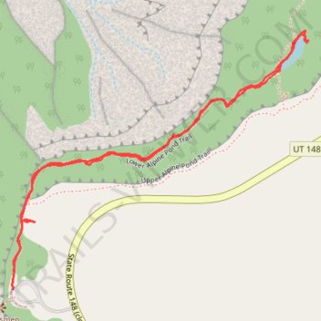
Lower Alpine Pond Trail
- Distance: 2.4 Km
- Elevation gain: 71 m
- Maximum elevation: 3,211 m
- Elevation loss: 71 m
- Minimum elevation: 3,186 m
- Moving time: 47 m 15 s
- Moving speed: 3.1 Km/h
- Maximum speed: 5.0 Km/h
- Total time: 1 h 31 m
- Global speed: 1.6 Km/h
Interactive trail map
Trail profile
- Distance: 2.4 Km
- Elevation gain: 71 m
- Maximum elevation: 3,211 m
- Elevation loss: 71 m
- Minimum elevation: 3,186 m
- Moving time: 47 m 15 s
- Moving speed: 3.1 Km/h
- Maximum speed: 5.0 Km/h
- Total time: 1 h 31 m
- Global speed: 1.6 Km/h
About this trail
Name: Lower Alpine Pond Trail trail, distance, elevation, map, profile, GPS track
Start: Alpine Pond Trail, Iron County, Utah, United States (37.63151 -112.83219)
End: State Route 148 (closed winters), Iron County, Utah, United States (37.63111 -112.83221)
Coordinates: 37.63111 -112.83224 37.63681 -112.82399