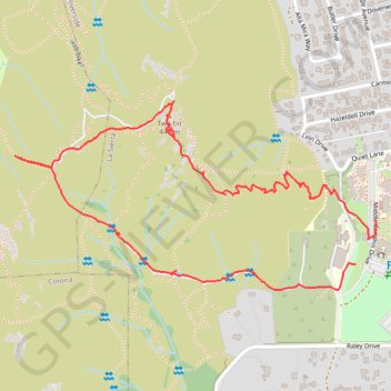
Two-bit Loop
- Distance: 3.1 Km
- Elevation gain: 180 m
- Maximum elevation: 432 m
- Elevation loss: 187 m
- Minimum elevation: 255 m
- Moving time: 55 m 8 s
- Moving speed: 3.4 Km/h
- Maximum speed: 17.4 Km/h
- Total time: 1 h 11 m
- Global speed: 2.6 Km/h
Interactive trail map
Trail profile
- Distance: 3.1 Km
- Elevation gain: 180 m
- Maximum elevation: 432 m
- Elevation loss: 187 m
- Minimum elevation: 255 m
- Moving time: 55 m 8 s
- Moving speed: 3.4 Km/h
- Maximum speed: 17.4 Km/h
- Total time: 1 h 11 m
- Global speed: 2.6 Km/h
About this trail
Name: Two-bit Loop trail, distance, elevation, map, profile, GPS track
Coordinates: 33.90938 -117.51417 33.91412 -117.50326