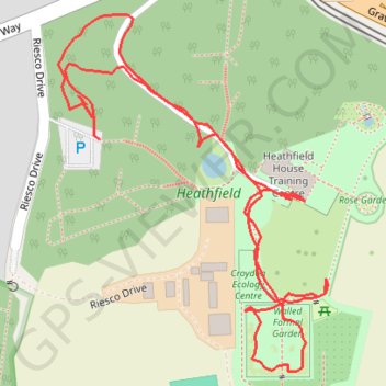
Heathfield
- Distance: 1.2 Km
- Elevation gain: 20 m
- Maximum elevation: 146 m
- Elevation loss: 22 m
- Minimum elevation: 125 m
- Moving time: 34 m 27 s
- Moving speed: 2.1 Km/h
- Maximum speed: 38.8 Km/h
- Total time: 40 m 46 s
- Global speed: 1.8 Km/h
Interactive trail map
Trail profile
- Distance: 1.2 Km
- Elevation gain: 20 m
- Maximum elevation: 146 m
- Elevation loss: 22 m
- Minimum elevation: 125 m
- Moving time: 34 m 27 s
- Moving speed: 2.1 Km/h
- Maximum speed: 38.8 Km/h
- Total time: 40 m 46 s
- Global speed: 1.8 Km/h
About this trail
Name: Heathfield trail, distance, elevation, map, profile, GPS track
Coordinates: 51.35569 -0.05863 51.35822 -0.05558