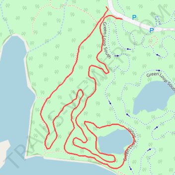
Anderson Park new Green
- Distance: 1.7 Km
- Elevation gain: 11 m
- Maximum elevation: 267 m
- Elevation loss: 9 m
- Minimum elevation: 260 m
- Moving time: 23 m 24 s
- Moving speed: 4.4 Km/h
- Maximum speed: 6.2 Km/h
- Total time: 23 m 24 s
- Global speed: 4.4 Km/h
Interactive trail map
Trail profile
- Distance: 1.7 Km
- Elevation gain: 11 m
- Maximum elevation: 267 m
- Elevation loss: 9 m
- Minimum elevation: 260 m
- Moving time: 23 m 24 s
- Moving speed: 4.4 Km/h
- Maximum speed: 6.2 Km/h
- Total time: 23 m 24 s
- Global speed: 4.4 Km/h
About this trail
Name: Anderson Park new Green trail, distance, elevation, map, profile, GPS track
Coordinates: 42.68996 -84.62454 42.69312 -84.62206
Other hiking, mountain biking, running and outdoor activity trails
Click on a trail to view its statistics, map and profile.
Theo Fulton Park, Hunters Ridge Park and Fine Park loop along Grand River
United States > Michigan > Eaton County > Lansing
Distance: 12.5 Km • Elevation gain: 71 m • Maximum elevation: 269 m