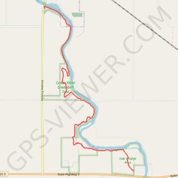
Cedar River Greenbelt Trail
- Distance: 6.7 Km
- Elevation gain: 74 m
- Maximum elevation: 356 m
- Elevation loss: 61 m
- Minimum elevation: 328 m
Interactive trail map
Trail profile
- Distance: 6.7 Km
- Elevation gain: 74 m
- Maximum elevation: 356 m
- Elevation loss: 61 m
- Minimum elevation: 328 m
About this trail
Name: Cedar River Greenbelt Trail trail, distance, elevation, map, profile, GPS track
Start: Junkyard Goat, Mitchell County, Iowa, 50461, United States (43.28467 -92.85552)
End: Cedar River Greenbelt, Mitchell, Mitchell County, Iowa, United States (43.31679 -92.87972)
Coordinates: 43.28467 -92.87972 43.31706 -92.85552