Old Sawmill Lane
- Distance: 1.5 Km
- Elevation gain: 59 m
- Maximum elevation: 159 m
- Elevation loss: 57 m
- Minimum elevation: 101 m
- Moving time: 24 m 35 s
- Moving speed: 3.7 Km/h
- Maximum speed: 9.0 Km/h
- Total time: 36 m 52 s
- Global speed: 2.5 Km/h
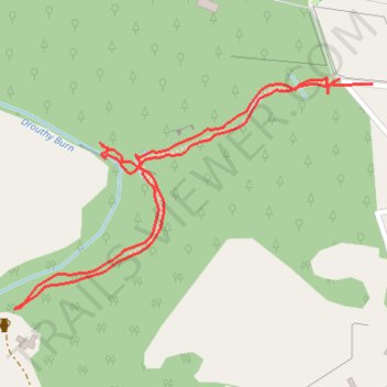
Interactive trail map
Trail profile
- Distance: 1.5 Km
- Elevation gain: 59 m
- Maximum elevation: 159 m
- Elevation loss: 57 m
- Minimum elevation: 101 m
- Moving time: 24 m 35 s
- Moving speed: 3.7 Km/h
- Maximum speed: 9.0 Km/h
- Total time: 36 m 52 s
- Global speed: 2.5 Km/h
About this trail
Name: Old Sawmill Lane trail, distance, elevation, map, profile, GPS track
Start: Forneth, Perth and Kinross, Scotland, PH10 6SN, United Kingdom (56.59769 -3.47555)
End: Forneth, Perth and Kinross, Scotland, PH10 6SN, United Kingdom (56.59781 -3.47460)
Coordinates: 56.59514 -3.48232 56.59788 -3.47460
Other hiking, mountain biking, running and outdoor activity trails
Click on a trail to view its statistics, map and profile.
North of Loch of Clunie
United Kingdom > Scotland > Perth and Kinross > Clunie
UK, Perthshire, Clunie
Distance: 12.2 Km • Elevation gain: 260 m • Maximum elevation: 189 m
Around Loch Ordie
United Kingdom > Scotland > Perth and Kinross
Mountain Bike Ride, UK, Perthshire, Dunkeld
Distance: 35.8 Km • Elevation gain: 579 m • Maximum elevation: 300 m