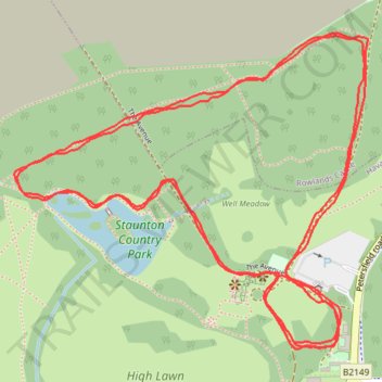
Havant Parkrun
- Distance: 5.0 Km
- Elevation gain: 51 m
- Maximum elevation: 46 m
- Elevation loss: 51 m
- Minimum elevation: 25 m
- Moving time: 31 m 33 s
- Moving speed: 9.4 Km/h
- Maximum speed: 21.5 Km/h
- Total time: 31 m 33 s
- Global speed: 9.4 Km/h
Interactive trail map
Trail profile
- Distance: 5.0 Km
- Elevation gain: 51 m
- Maximum elevation: 46 m
- Elevation loss: 51 m
- Minimum elevation: 25 m
- Moving time: 31 m 33 s
- Moving speed: 9.4 Km/h
- Maximum speed: 21.5 Km/h
- Total time: 31 m 33 s
- Global speed: 9.4 Km/h
About this trail
Name: Havant Parkrun trail, distance, elevation, map, profile, GPS track
Coordinates: 50.87534 -0.98252 50.88056 -0.97325