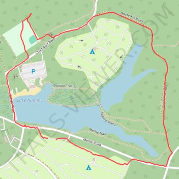
Lake Nummy Loop - Belleplain State Forest
- Distance: 3.0 Km
- Elevation gain: 7 m
- Maximum elevation: 13 m
- Elevation loss: 7 m
- Minimum elevation: 8 m
- Moving time: 52 m 7 s
- Moving speed: 3.5 Km/h
- Maximum speed: 7.4 Km/h
- Total time: 55 m 6 s
- Global speed: 3.3 Km/h
Interactive trail map
Trail profile
- Distance: 3.0 Km
- Elevation gain: 7 m
- Maximum elevation: 13 m
- Elevation loss: 7 m
- Minimum elevation: 8 m
- Moving time: 52 m 7 s
- Moving speed: 3.5 Km/h
- Maximum speed: 7.4 Km/h
- Total time: 55 m 6 s
- Global speed: 3.3 Km/h
About this trail
Name: Lake Nummy Loop - Belleplain State Forest trail, distance, elevation, map, profile, GPS track
Coordinates: 39.24355 -74.85878 39.25053 -74.84908