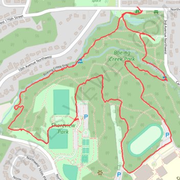
Boeing Creek Park Loop
- Distance: 3.9 Km
- Elevation gain: 92 m
- Maximum elevation: 145 m
- Elevation loss: 93 m
- Minimum elevation: 71 m
- Moving time: 1 h 11 m
- Moving speed: 3.3 Km/h
- Maximum speed: 7.6 Km/h
- Total time: 1 h 30 m
- Global speed: 2.6 Km/h
Interactive trail map
Trail profile
- Distance: 3.9 Km
- Elevation gain: 92 m
- Maximum elevation: 145 m
- Elevation loss: 93 m
- Minimum elevation: 71 m
- Moving time: 1 h 11 m
- Moving speed: 3.3 Km/h
- Maximum speed: 7.6 Km/h
- Total time: 1 h 30 m
- Global speed: 2.6 Km/h
About this trail
Name: Boeing Creek Park Loop trail, distance, elevation, map, profile, GPS track
Coordinates: 47.74945 -122.37045 47.75605 -122.36081