Ride up to Pentland Hills Regional Park
- Distance: 30.3 Km
- Elevation gain: 354 m
- Maximum elevation: 287 m
- Elevation loss: 354 m
- Minimum elevation: 63 m
- Moving time: 1 h 37 m
- Moving speed: 18.6 Km/h
- Maximum speed: 48.1 Km/h
- Total time: 1 h 39 m
- Global speed: 18.2 Km/h
Interactive trail map
Trail profile
- Distance: 30.3 Km
- Elevation gain: 354 m
- Maximum elevation: 287 m
- Elevation loss: 354 m
- Minimum elevation: 63 m
- Moving time: 1 h 37 m
- Moving speed: 18.6 Km/h
- Maximum speed: 48.1 Km/h
- Total time: 1 h 39 m
- Global speed: 18.2 Km/h
About this trail
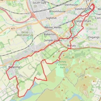
Name: Ride up to Pentland Hills Regional Park trail, distance, elevation, map, profile, GPS track
Coordinates: 55.86016 -3.35001 55.93365 -3.22583
Other hiking, mountain biking, running and outdoor activity trails
Click on a trail to view its statistics, map and profile.
Cycleroute Edinburgh
United Kingdom > Scotland > City of Edinburgh
Summer!
Distance: 76.4 Km • Elevation gain: 886 m • Maximum elevation: 325 m