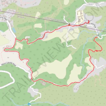
Apugan/Loganan road
- Distance: 4.1 Km
- Elevation gain: 264 m
- Maximum elevation: 1,661 m
- Elevation loss: 243 m
- Minimum elevation: 1,415 m
Interactive trail map
Trail profile
- Distance: 4.1 Km
- Elevation gain: 264 m
- Maximum elevation: 1,661 m
- Elevation loss: 243 m
- Minimum elevation: 1,415 m
About this trail
Name: Apugan/Loganan road trail, distance, elevation, map, profile, GPS track
Coordinates: 16.36344 120.56881 16.37104 120.58063