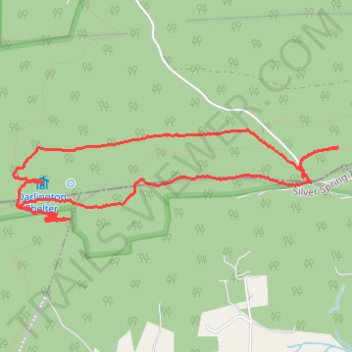
Darlington, Appalachian, and other State Game Lands Number 170 trails
- Distance: 7.8 Km
- Elevation gain: 214 m
- Maximum elevation: 396 m
- Elevation loss: 214 m
- Minimum elevation: 302 m
- Moving time: 1 h 30 m
- Moving speed: 5.2 Km/h
- Maximum speed: 11.4 Km/h
- Total time: 1 h 33 m
- Global speed: 5.0 Km/h
Interactive trail map
Trail profile
- Distance: 7.8 Km
- Elevation gain: 214 m
- Maximum elevation: 396 m
- Elevation loss: 214 m
- Minimum elevation: 302 m
- Moving time: 1 h 30 m
- Moving speed: 5.2 Km/h
- Maximum speed: 11.4 Km/h
- Total time: 1 h 33 m
- Global speed: 5.0 Km/h
About this trail
Name: Darlington, Appalachian, and other State Game Lands Number 170 trails trail, distance, elevation, map, profile, GPS track
Coordinates: 40.29938 -77.08945 40.30546 -77.06095
Other hiking, mountain biking, running and outdoor activity trails
Click on a trail to view its statistics, map and profile.
Darlington Trail and Other Trails in State Game Lands Number 170
United States > Pennsylvania > Perry County > Rye Township
Distance: 5.7 Km • Elevation gain: 117 m • Maximum elevation: 376 m