Import a GPX file

SaintLaurent trails

Click on a trail to view its statistics, map and profile.
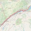
Brockville - Lancaster

Canada > Ontario > Brockville > Brockville

Saint-Laurent River. #Bike #SaintLaurent

Distance: 135.3 Km • Elevation gain: 489 m • Maximum elevation: 101 m

Gear up for your next adventure:

📕Australia Maps - Maps covering Australian regions
🥶Thermal Beanies - Warm hats for cold hikes
🦟Insect Repellent - Protection against insects
🔋Solar Power Banks - Solar chargers for outdoors
👟Lightweight Trail Runners - Agile footwear for fast movement over rugged Australian terrain

As an Amazon Associate, this site earns from qualifying purchases at no extra cost to you.