Import a GPX file

Griffin trails

Click on a trail to view its statistics, map and profile.
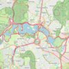
Canberra - Lake Burley Griffin

Australia > Canberra

#Hiking #Bike #Loop #Canberra

Distance: 36.9 Km • Elevation gain: 302 m • Maximum elevation: 583 m

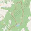
EMTB Gravel: Loch of Grandtully - Loop

United Kingdom > Scotland > Perth and Kinross > Aberfeldy

Around Loch Grandtully #UK #Perthshire #Aberfeldy #Griffin #Wood

Distance: 17.9 Km • Elevation gain: 341 m • Maximum elevation: 457 m

Gear up for your next adventure:

🔋Rechargeable Batteries - Eco-friendly power for high-drain GPS units and flashlights
🖼️Scratch-off Australia Map - Track the regions and peaks you have explored geographically
🧦Merino Wool Hiking Socks - Moisture-wicking socks to prevent blisters during long topographic surveys
🧥Thermal Emergency Blankets - Compact Mylar blankets to prevent hypothermia if stranded overnight
🎒40L Day Hiking Backpacks - Comfortable packs with hydration support for long days exploring topographic peaks

As an Amazon Associate, this site earns from qualifying purchases at no extra cost to you.