Import a GPX file

Gander trails

Click on a trail to view its statistics, map and profile.
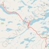
Gander - Mallorytown

Canada > Newfoundland and Labrador > Gander

#Bike #Gander #Mallorytown #Newfoundland

Distance: 101.3 Km • Elevation gain: 882 m • Maximum elevation: 146 m
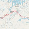
Grand Falls-Windsor - Gander

Canada > Newfoundland and Labrador > Grand Falls-Windsor

#Bike #GrandFalls #Windsor #Gander #Newfoundland

Distance: 98.4 Km • Elevation gain: 699 m • Maximum elevation: 145 m

Gear up for your next adventure:

🥤Outdoor Water Bottles - Reusable bottles for outdoor activities
🛰️Handheld GPS Units - Rugged GPS devices for tracking coordinates and elevation in the Australian bush
📕Australia Maps - Maps covering Australian regions
🧥Insulated Down Jackets - High warmth-to-weight ratio for cold nights in the high country
⛺Ultralight Solo Tents - Compact shelters for multi-day topographic surveying expeditions

As an Amazon Associate, this site earns from qualifying purchases at no extra cost to you.