Import a GPX file

Ammonite trails

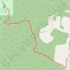
Click on a trail to view its statistics, map and profile.

Ammonite Falls

Canada > British Columbia > Regional District of Nanaimo > Area C (Arrowsmith-Benson)

Benson Creek Falls Regional Park. Vancouver Island. #Hiking #Ammonite #Vancouver

Distance: 4.8 Km • Elevation gain: 156 m • Maximum elevation: 269 m

Gear up for your next adventure:

👖Convertible Hiking Trousers - Zip-off legs to adapt to changing temperatures throughout the day
🛰️Handheld GPS Units - Rugged GPS devices for tracking coordinates and elevation in the Australian bush
🔥Camping Stoves - Portable stoves for outdoor cooking
📍Handheld GPS - GPS devices for hiking and navigation
🔋Rechargeable Batteries - Eco-friendly power for high-drain GPS units and flashlights

As an Amazon Associate, this site earns from qualifying purchases at no extra cost to you.