Import a GPX file

Sant'Alessandro trails

Click on a trail to view its statistics, map and profile.
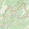
Riva del Garda - Pergine Valsugana

Italy > Trentino – Alto Adige/Südtirol > Provincia di Trento > Riva del Garda > Sant'Alessandro > Alboletta

One-way between Riva del Garda and Pergine Valsugana.

Distance: 193.3 Km • Elevation gain: 5,511 m • Maximum elevation: 2,038 m

Other places

Gear up for your next adventure:

🦯Trekking Poles - Walking poles for hiking stability
🧰Survival Kits - Essential survival gear
🚴Bike GPS - GPS devices for cycling
🧴SPF 50+ Bulk Sunscreen - Maximum protection for long-term outdoor exposure
🏃Compression Recovery Socks - Reduce leg fatigue after heavy days of elevation gain

As an Amazon Associate, this site earns from qualifying purchases at no extra cost to you.