Import a GPX file

Meurthe-et-Moselle trails

Click on a trail to view its statistics, map and profile.
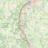
Marche Nancy - Metz

France > Grand Est > Meurthe-et-Moselle > Maxéville

Distance: 64.6 Km • Elevation gain: 810 m • Maximum elevation: 356 m
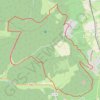
Mont-le-Vignoble

France > Grand Est > Meurthe-et-Moselle > Mont-le-Vignoble

Distance: 14.8 Km • Elevation gain: 381 m • Maximum elevation: 420 m

Other places

 •

Gear up for your next adventure:

🧴Sunscreen SPF - Sun protection for outdoor activities
🍶Collapsible Water Bottles - Save space in your pack as you consume your water supply
🪢550 Survival Paracord - Versatile cordage for gear repair and emergency lashing
🔪Outdoor Multi-tools - Versatile tools for gear repair and survival tasks in the wilderness
🔋Rechargeable Batteries - Eco-friendly power for high-drain GPS units and flashlights

As an Amazon Associate, this site earns from qualifying purchases at no extra cost to you.