Import a GPX file

Area F (Alberni Highway) trails

Click on a trail to view its statistics, map and profile.
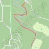
Little Qualicum Falls

Canada > British Columbia > Regional District of Nanaimo > Area F (Alberni Highway)

Little Qualicum Falls Provincial Park, Vancouver Island. #Hiking #Falls #River #Forest #Park #Vancouver #Island

Distance: 2.9 Km • Elevation gain: 43 m • Maximum elevation: 159 m

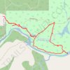
Cougar trails

Canada > British Columbia > Regional District of Nanaimo > Area F (Alberni Highway)

Distance: 4.4 Km • Elevation gain: 57 m • Maximum elevation: 81 m

Gear up for your next adventure:

🔪Outdoor Multi-tools - Versatile tools for gear repair and survival tasks in the wilderness
🧥Insulated Down Jackets - High warmth-to-weight ratio for cold nights in the high country
🗺️Topographic Maps - Detailed maps for hiking and navigation
🔋Solar Power Banks - Charge your phone and GPS using the sun while deep in the bush
👟Lightweight Trail Runners - Agile footwear for fast movement over rugged Australian terrain

As an Amazon Associate, this site earns from qualifying purchases at no extra cost to you.