
County Antrim trails
Click on a trail to view its statistics, map and profile.
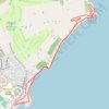
Blackhead Path
United Kingdom > Northern Ireland > County Antrim > Whitehead
Distance: 4.5 Km • Elevation gain: 115 m • Maximum elevation: 53 m

Belfast to Dungannon
United Kingdom > Northern Ireland > County Antrim > Belfast
Bicycle ride from Belfast Big Fish to Dungannon.
Distance: 83.3 Km • Elevation gain: 549 m • Maximum elevation: 75 m

Further traces in Brackmuckley Forest
United Kingdom > Northern Ireland > County Antrim > Portglenone
Distance: 2.9 Km • Elevation gain: 12 m • Maximum elevation: 22 m

Lagan & Lough
United Kingdom > Northern Ireland > County Antrim > Tullynacross
Distance: 29.4 Km • Elevation gain: 153 m • Maximum elevation: 35 m