Import a GPX file

Ratley trails

Click on a trail to view its statistics, map and profile.
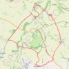
Ratley Radway Lwr Tysoe Alkerton Hornton trailrun route

United Kingdom > England > Warwickshire > Stratford-on-Avon > Ratley

Morning Run

Distance: 19.2 Km • Elevation gain: 412 m • Maximum elevation: 218 m

Gear up for your next adventure:

🥾Hiking Shoes - Lightweight hiking shoes for day hikes
🥤Hydration Packs - Hydration systems for hiking
👖Convertible Hiking Trousers - Zip-off legs to adapt to changing temperatures throughout the day
🧭Military Style Lensatic Compass - Durable sighting compasses for advanced land navigation and surveying
⌚Altimeter Watches - Watches with altitude tracking

As an Amazon Associate, this site earns from qualifying purchases at no extra cost to you.