
Seneca Rocks trails
Click on a trail to view its statistics, map and profile.
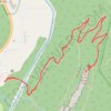
Seneca Rocks Trail in Monongahela National Forest
United States > West Virginia > Pendleton County > Seneca Rocks
Hiking the Seneca Rocks Trail is a delightful journey through the heart of West Virginia's breathtaking landscapes. As you ascend, the impressive rock formations tower above, providing stunning views of the lush valleys and distant mountain ridges, while the well-maintained path features gentle switchbacks and…
Distance: 5.0 Km • Elevation gain: 253 m • Maximum elevation: 703 m