Import a GPX file

Jackson County trails

Click on a trail to view its statistics, map and profile.
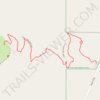
Upper Table Rock Trail

United States > Oregon > Jackson County

Distance: 2.8 Km • Elevation gain: 230 m • Maximum elevation: 623 m

Whisky springs campground

United States > Oregon > Jackson County

Distance: 1.7 Km • Elevation gain: 24 m • Maximum elevation: 974 m

Gear up for your next adventure:

🧣Merino Neck Gaiters - Versatile headwear for warmth, sun protection, or dust filtering
🧦Hiking Socks - Comfortable socks for long hikes
📦Crushproof Equipment Cases - Safe transport for sensitive surveying and mapping instruments
🦯Trekking Poles - Walking poles for hiking stability
📱Shockproof Phone Cases - Extra protection for your smartphone against drops on rocky terrain

As an Amazon Associate, this site earns from qualifying purchases at no extra cost to you.