Import a GPX file

Sulphur Springs trails

Click on a trail to view its statistics, map and profile.
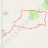
Alamao Canyon Loop in Valles Caldera National Preserve

United States > New Mexico > Sandoval County > Sulphur Springs

Distance: 19.1 Km • Elevation gain: 518 m • Maximum elevation: 2,871 m

Gear up for your next adventure:

💡Collapsible Camping Lanterns - Illuminate your base camp or tent for map studying at night
🖼️Scratch-off Australia Map - Track the regions and peaks you have explored geographically
🩹Blister Prevention Tape - Apply to friction points before they become painful sores
☕Outdoor Coffee Makers - Enjoy quality coffee at the summit of your favorite peak
🔋Solar Power Banks - Charge your phone and GPS using the sun while deep in the bush

As an Amazon Associate, this site earns from qualifying purchases at no extra cost to you.