
Saint-Arnaud trails
Click on a trail to view its statistics, map and profile.
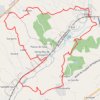
Bajamont, le circuit des fontaines et lavoirs
France > Nouvelle-Aquitaine > Lot-et-Garonne > Bajamont > Saint-Arnaud
Lac, fontaines et lavoirs offrent des haltes rafraîchissantes sur ce circuit, tracé dans un paysage tourmenté du Pays de Serres, aux portes d’Agen et de la vallée de la Garonne. Suite aux inondations de 1993, le Syndicat Intercommunal d'Aménagement de La Masse et de La Laurendanne constitué en 1994 par…
Distance: 11.4 Km • Elevation gain: 353 m • Maximum elevation: 202 m