Import a GPX file

Camden County trails

Click on a trail to view its statistics, map and profile.
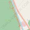
Canal Road and Supple Jack Trail Loop in Dismal Swamp State Park

United States > North Carolina > Camden County

Distance: 3.4 Km • Elevation gain: 12 m • Maximum elevation: 11 m

Gear up for your next adventure:

Altimeter Barometer Watches - Outdoor watches with built-in sensors to track altitude changes and weather shifts
🧭Global Orienteering Compass - High-precision liquid-filled compasses for accurate map reading and navigation
🧥Packable Rain Jackets - Breathable waterproof layers for unpredictable mountain weather
🧴SPF 50+ Bulk Sunscreen - Maximum protection for long-term outdoor exposure
🎒Hiking Backpacks - Backpacks designed for hiking and trekking

As an Amazon Associate, this site earns from qualifying purchases at no extra cost to you.