Import a GPX file

Mammoth Lakes trails

Click on a trail to view its statistics, map and profile.

Duck Lake, Barney Lake, Skelton Lake and Arrowhead Lake via Duck Pass Trail

United States > California > Mono County > Mammoth Lakes

The Duck Pass Trail in the Inyo National Forest is a favorite for hiking enthusiasts, offering breathtaking views and access to pristine alpine lakes such as Skelton Lake, Barney Lake, and the expansive Duck Lake. The trail begins in a shaded forest with steady climbs and switchbacks, opening up to serene…

Distance: 9.0 Km • Elevation gain: 585 m • Maximum elevation: 3,284 m

Mammoth Lakes Loop

United States > California > Mono County > Mammoth Lakes > Lake Mary

Loop hike via Lake Mary, Lake Barret, T J Lake, Lake George, Lake Mamie and Mammoth Creek in the Inyo National Forest. #Hiking #Loop #Lake #Forest #Nature #River #Mountain

Distance: 5.4 Km • Elevation gain: 159 m • Maximum elevation: 2,842 m

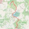
Mammoth to Bridgeport

United States > California > Mono County > Mammoth Lakes

Northern California Backcountry Discovery Route (CABDR-North)

Distance: 152.5 Km • Elevation gain: 2,191 m • Maximum elevation: 2,822 m

Other places

Gear up for your next adventure:

📟Satellite Messengers - Two-way satellite communication to stay in touch beyond the cellular grid
🗺️Topographic Maps - Detailed maps for hiking and navigation
🧰Survival Kits - Essential survival gear
🔋Rechargeable Batteries - Eco-friendly power for high-drain GPS units and flashlights
🦘Outback Survival Gear - Essential gear for Australian outback

As an Amazon Associate, this site earns from qualifying purchases at no extra cost to you.