Import a GPX file

Pequannock Township trails

Click on a trail to view its statistics, map and profile.
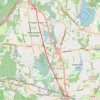
Trace of the completed Pompton Valley Rail Trail in Pompton Plains, NJ

United States > New Jersey > Morris County > Pequannock Township

Distance: 16.7 Km • Elevation gain: 57 m • Maximum elevation: 62 m

Gear up for your next adventure:

🗺️Topographic Maps - Detailed maps for hiking and navigation
🐍Snake Gaiters - Protection against snake bites
🧭Global Orienteering Compass - High-precision liquid-filled compasses for accurate map reading and navigation
🧺Waterproof Dry Sacks - Organize your pack and keep electronics safe from rain and river crossings
🥾Hiking Gaiters - Leg protection for trails

As an Amazon Associate, this site earns from qualifying purchases at no extra cost to you.