Import a GPX file

Lakewood trails

Click on a trail to view its statistics, map and profile.
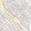
Trail from S Coors St to W Jewell Ave. "Loveland Trail"

United States > Colorado > Jefferson County > Lakewood

Distance: 1.1 Km • Elevation gain: 50 m • Maximum elevation: 1,836 m

Gear up for your next adventure:

🥾Heavy Duty Hiking Boots - Ankle-supporting boots for carrying heavy packs on steep contours
🪑Portable Backpacking Chairs - A comfortable seat for studying maps at the end of the day
🦶Orthotic Hiking Insoles - Extra arch support for long-distance topographic treks
🏃Compression Recovery Socks - Reduce leg fatigue after heavy days of elevation gain
⌚GPS Watches - GPS watches for outdoor sports

As an Amazon Associate, this site earns from qualifying purchases at no extra cost to you.