Import a GPX file

Kittery trails

Click on a trail to view its statistics, map and profile.
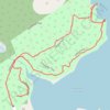
Leland Loop Trail

United States > Maine > York County > Kittery > Kittery Point

Distance: 1.7 Km • Elevation gain: 32 m • Maximum elevation: 18 m
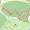
Fort McClary

United States > Maine > York County > Kittery > Kittery Point

Distance: 0.8 Km • Elevation gain: 21 m • Maximum elevation: 19 m

Other places

Gear up for your next adventure:

🧥Down Jackets - Insulated jackets for cold weather
🧺Fast-Dry Microfiber Towels - Large towels that pack down to the size of an orange
🎧Bluetooth Outdoor Earbuds - Listen to navigation cues or podcasts during long solo treks
🔥Ferrocerium Rod Fire Starters - Reliable fire lighting in wet or windy conditions without matches
🕶️Polarized Outdoor Sunglasses - Reduce glare from rocks and water for better visual navigation

As an Amazon Associate, this site earns from qualifying purchases at no extra cost to you.