Import a GPX file

Papplewick CP trails

Click on a trail to view its statistics, map and profile.
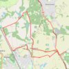
Gravel loop ride between Burntstump Country Park and Newstead Abbey Gardens

United Kingdom > England > Nottinghamshire > Gedling > Papplewick CP

Distance: 17.4 Km • Elevation gain: 163 m • Maximum elevation: 123 m

Gear up for your next adventure:

🧊Insulated Cooler Bags - Keep food fresh for day trips to remote geographic sites
🛰️Handheld GPS Units - Rugged GPS devices for tracking coordinates and elevation in the Australian bush
🎽Base Layers - Thermal base layers
☀️Portable Solar Chargers - High-efficiency panels to hang on your backpack while walking
🖼️Scratch-off Australia Map - Track the regions and peaks you have explored geographically

As an Amazon Associate, this site earns from qualifying purchases at no extra cost to you.