Import a GPX file

Portneuf (MRC) trails

Click on a trail to view its statistics, map and profile.
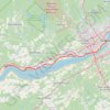
Portneuf - Québec

Canada > Quebec > Portneuf (MRC) > Portneuf

Saint Lawrence River. #Bike #Portneuf #Québec #SaintLawrence

Distance: 66.8 Km • Elevation gain: 547 m • Maximum elevation: 90 m

Other places

Gear up for your next adventure:

🛰️Handheld GPS Units - Rugged GPS devices for tracking coordinates and elevation in the Australian bush
🧊Insulated Stainless Steel Flasks - Keep water cold for 24 hours in the heat or coffee hot in the cold
🔋Solar Power Banks - Charge your phone and GPS using the sun while deep in the bush
👟Lightweight Trail Runners - Agile footwear for fast movement over rugged Australian terrain
🎽Hiking Clothing - Breathable clothing for hiking

As an Amazon Associate, this site earns from qualifying purchases at no extra cost to you.