
Area F (Cowichan Lake South / Skutz Falls) trails
Click on a trail to view its statistics, map and profile.
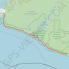
West Coast Trail (Vancouver Island)
Canada > British Columbia > Cowichan Valley Regional District > Area F (Cowichan Lake South / Skutz Falls)
Hike along the West Coast Trail via Camper Bay, Cullite Cove, Logan Creek Bridge, Wallbran Creek Camp, Bonilla Creek, Carmanah Creek Camp, Cribs Creek Camp, Dare Point, Nitinat River, Tsuquadra Point Camp, Tsusiat Falls, Klanawa River, Tsocowis Creek Camp, Darling River Camp, Michigan Creek Camp, Pachena Point…
Distance: 68.6 Km • Elevation gain: 1,832 m • Maximum elevation: 123 m