Import a GPX file

Midvaal Local Municipality trails

Click on a trail to view its statistics, map and profile.
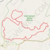
Suikerbosrand Nature Reserve

South Africa > Gauteng > Sedibeng District Municipality > Midvaal Local Municipality

#Bike #Loop #Suikerbosrand

Distance: 57.3 Km • Elevation gain: 1,269 m • Maximum elevation: 1,901 m

Gear up for your next adventure:

🛰️Handheld GPS Units - Rugged GPS devices for tracking coordinates and elevation in the Australian bush
🎒40L Day Hiking Backpacks - Comfortable packs with hydration support for long days exploring topographic peaks
🎒Tactical Waist Packs - Quick access to your compass, phone, and snacks while walking
🧴SPF 50+ Bulk Sunscreen - Maximum protection for long-term outdoor exposure
🧥Thermal Emergency Blankets - Compact Mylar blankets to prevent hypothermia if stranded overnight

As an Amazon Associate, this site earns from qualifying purchases at no extra cost to you.